Scotland 2002
Scotland was a more unique trip for the NMBS for the usual interest in 20th Century Battlefields were replaced with the Battlefields of the Anglo-Scottish wars and Neolithic
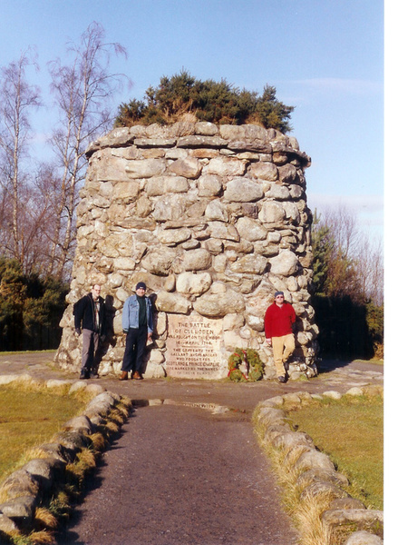
sites. The main aim was Culloden the last battle to be fought on British Soil. A little gem and a bonus was the battlefield of Killiecrankie and we located the battlefield! We may brag but
a few years later the BBC TV series "Two Men in a Trench" used all kinds of gimmicks and found it! We found it with an OS map, and a good description of the battlefield.
We also found on our trails other great sites like the Neolithic Clava Cairns (near Culloden) the Ruthern Barracks (part of the General Wade 'push') and many Wade roads and bridges. Rob Roy's Grave
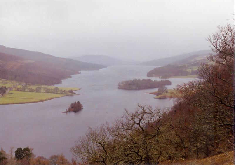
(yes he is not a Hollywood film). Other sites in the area are Blair Castle and Blair Athol, and the breathtaking "Queens View" just outside Pitlochry.
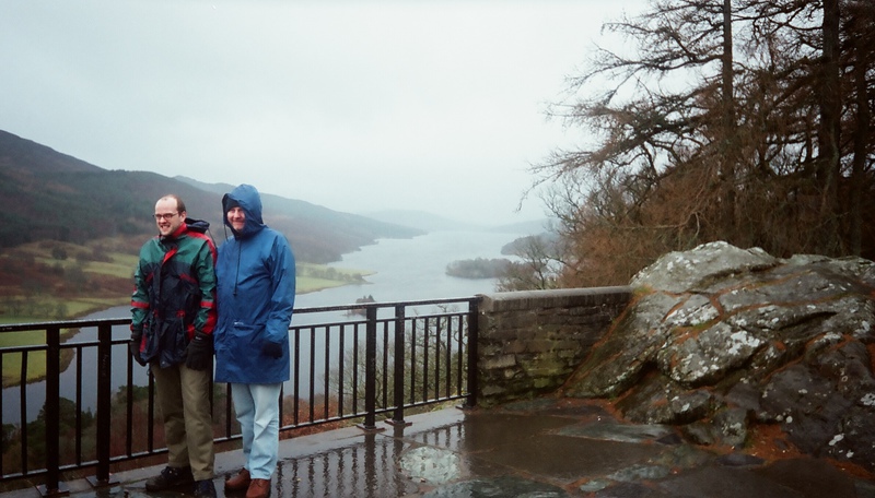 Andrew and Gerry at a very wet Queen's view
Disappointment loomed with Bannockburn and Stirling being closed for the winter - but we found solace in the fact that this area of Scotland, where we made our base was home to the Moulin Inn and Micro Brewery - and just up the road two of the finest distilleries in Scotland Edradour (the Smallest in Scotland) and Dalwhinnie (the Highest and Coldest).
It was nice after a hard day’s trip of walking
around a battlefield to have some nice food a sample a decent pint. One of the pleasures was finding the wonderful Moulin Brewery and the Moulin Pub. The pub was about 2 miles away from the cottage
where we stayed so it was good to have a quick pint before heading home and cooking the night’s meal.
Moulin was like a pub of jukeboxes and pool tables, but for a quaint pub it was clichéd and they lost custom. Only their removal and a general refurbishment saw the customers return again.
Over the last 20 or so years have seen many changes, most noteworthy the setting up of the adjacent Moulin Brewery, the provision of Ales from The Moulin’s own Brew house added a unique ingredient
that quickly saw a steady stream of new visitors to the Inn.
A special mention has to go to the other local, the Athol arms at Blair Athol. Good food, great beer and clever enough to stock beer from the Moulin Brewery. But, enough of the pubs and onto the
Battlefields.
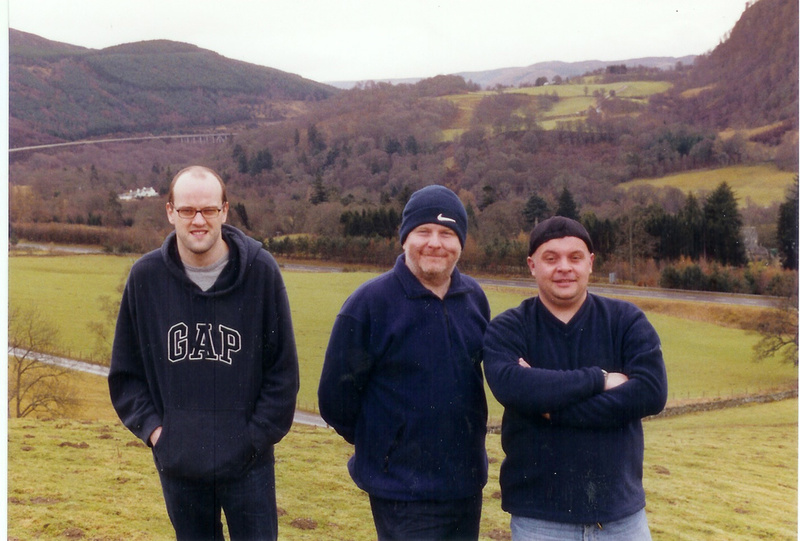
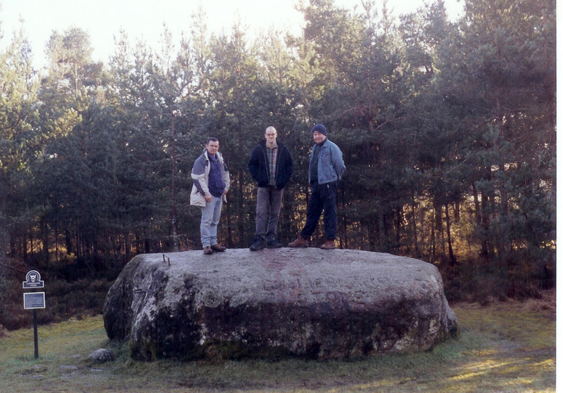
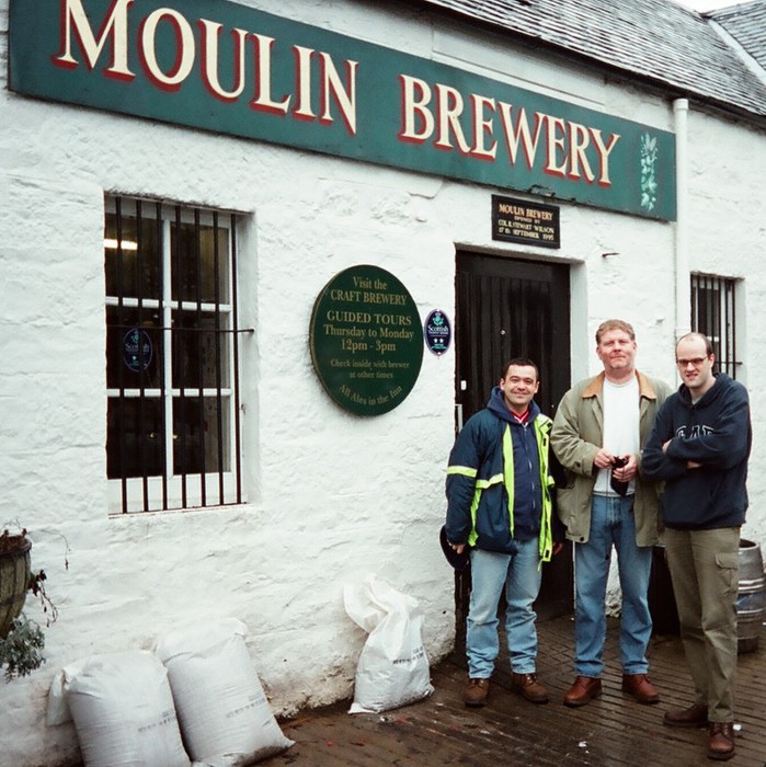 Lance, Gerry and Andrew outside the Moulin Brewery
Near the Battlefield at Culloden stand a
wonderful Neolithic site called The Clava Cairns - or more correctly Bulnaraun of Clava - is one of the best preserved Bronze Age burial sites in Scotland. There are three cairns here, two with
passage ways aligned to the Midwinter sunset, and all with more subtle features, incorporated to reflect the importance of the South-west horizon.
The site consists of 3 small, relatively well preserved burial chambers, aligned on a North-east to South-west axis. Each cairn consists of a multitude of large water-worn pebbles and boulders, piled
in a bun shape, with an outer kerb of larger stones, around which stands a stone circle. The two outer cairns have passages to a central chamber aligned South-west to the Midwinter sun, while the
central cairn has only an inner chamber with no connecting passage.
The cairns are thought to date from the late Neolithic period, and this type of cairn seems to be a style developed in this part of Scotland, which are collectively known as Clava Cairns. Unlike the
larger Neolithic tombs found in other parts of the country, it seems that the tombs at Clava were not used over a long period of time for a large community, rather evidence suggests that they were
preserved for more elite members of a tribe. This could be (and I guess here), perhaps a ruling caste or priesthood.
Some of the large boulders which make up the outer facing of the cairns have been carved with enigmatic cup and ring markings. The true purpose and meaning of these carvings is unknown, and it has
been suggested that the cup marked stones may actually date from an earlier period of history, the site being re-used because of its importance. I have seen other cup and ring marking in other stones
– I love Neolithic stones and have used the ex-Teardrop Explodes singer, Julian Cope’s wonderful book; The Modern
Antiquarian: A Pre-Millennial Odyssey through Megalithic Britain as a guide.
But seeing the sheer size of the cairns at Clava surprised me compared to other ones I have seen in Scotland, for example Cairn Holy I and Cairn Holy II near Gatehouse of Fleet in
Galloway. Examining the carved stones it is easy to see that they must have been carved before they
were incorporated into the fabric of the cairns.
Other more subtle features were incorporated into the construction of the tombs. The kerb stones are graded in size towards the South-west and the Midwinter sun, with the largest facing towards that
direction. This grading is also true of the surrounding standing stones.
The stones may even be colour graded, as it seems that the more colourful stones also lie to the South-west of the tombs. This attention to geometric detail suggests that the tombs were constructed
as part of a larger plan with bias towards the South-west horizon.
 Andrew, Gerry and Lance at Clava
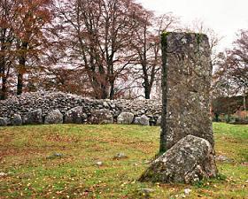 Clava Cairns
Most people will think that the Scottish legend,
Rob Roy is either Stuff of Walter Scott's writing or the Hollywood film that bears his name. But no, Rob Roy was a REAL person.
To get to see his grave in Balquhidder we had to drive from Pitlochry via the beautiful Sma’ Glen, which means Small Glen and is Idyllic Scotland at its best. The Sma’ Glen is a scenic glen in
central Perthshire, located 5 miles to the north of Crieff.
The fast flowing River Almond runs along the narrow valley floor and the glen itself, is rather small, at only 4 miles (6.5 km) in length. The Romans built a fort and watchtower here, General Wade
built a military road here in the 18th century and the glen featured in the 1981 film Chariots of Fire.
At the northern end of the Sma' Glen keep an eye out for Clach Ossian or Ossian's Stone, an 8 ft high monolithic stone sited where the river and the road almost touch. This is reputed to be the
burial place, in about 300 AD, of the legendary Gaelic bard Ossian. He was the father of Fingal who was immortalised in Mendelssohn's Fingal's Cave overture.
Balquhidder is little more than a village, yet it draws visitors from across the world because of its association with Rob Roy. The intrepid outlaw is buried in the churchyard, under the crumbling
ruins of the old 17th century church.
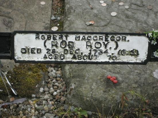
The grave is simple, with a low iron railing, and you can get as close to it as you wish. The inscription at the head of the grave says it all; "Macgregor despite them". Beside are the graves of Rob
Roy's wife and two of their four sons, Coll and Robin. It seems likely that the gravestones were reused, for they appear to be of a much earlier date than the death of the Macgregor’s would
indicate.
The story of Robin Macgregor is a strange one. He killed a Malaren of Invernenty in a land dispute, but escaped punishment, but later he was found guilty of kidnapping a wealthy widow and was hanged
in Edinburgh. He was brought back to Balquhidder in ceremony and laid in the grave of his brother Coll.
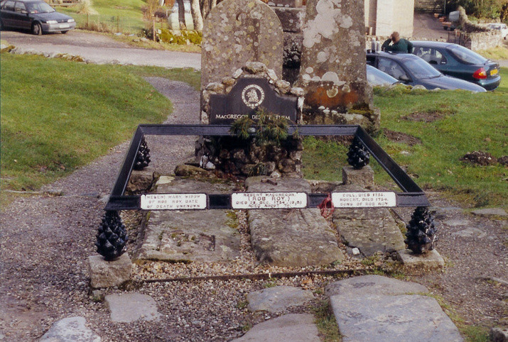 Rob Roy's Grave (Centre)
 Rob Roy's Grave
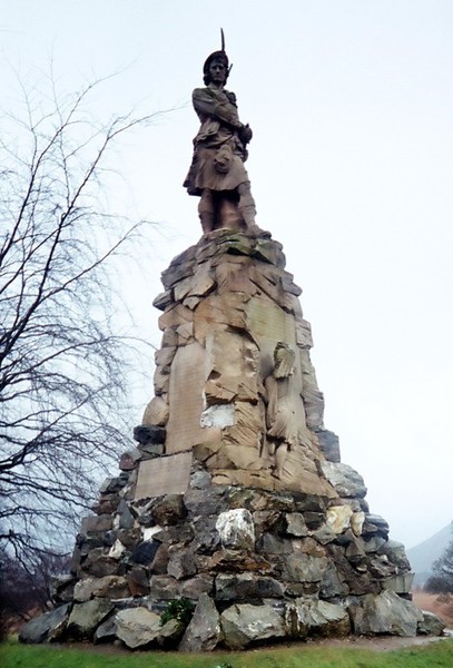
Cuil Lodiar or Culloden is famous for two things. It is the last battle ever
fought on British soil and it was the final act of a Scottish monarch to try and take the English on face to face, although Alex Salmond of the SNP is doing a rather good job at the
moment!
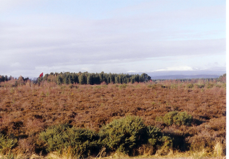
After a long drive up the A9, just to the East of Inverness the battlesite lies. The battlefield itself is not as big as you would expect, the field is part swamp and part heather moorland - so good
walking boots are always a must.
When the NMBS were trotting round, well known Scottish hard man actor, James Cosmo was doing a documentary. Cosmo has appeared in films such as Highlander, Troy, Braveheart and he played
Renton's dad in "Trainspotting" and he is in the cult TV series "Game of Thrones" - it was a nice extra to the trip to see him.
The Battle of Culloden - April 16th 1746 - marked the fall of the Jacobite rebellion of 1745, which sought to restore the Stuart monarchy to the throne. In barely 40 minutes of fighting, the massed
army of Bonnie Prince Charlie had been slaughtered by government troops (which also contained Scottish clans) led by Prince William the Duke of Cumberland.
The odds were already stacked against them, the boggy, rain sodden ground of the moor was not suited to the Highland charge, they were vastly outnumbered, and they were exhausted after a many days
marching back from England where they had failed to muster the support they badly needed to ensure victory. They had also launched a surprise attack on their foes during the night which had ended
without them even coming into contact with the Duke's men.
The battle started with an exchange of artillery that quickly became a one sided affair, as the Jacobite gunners were vastly outnumbered and outclassed. Twenty minutes of constant bombardment
decimated the Jacobite lines as they awaited the order to charge. Bonnie Prince Charlie took no part in the battle, and with no leader to sound orders their hesitations was to play a large part in
their defeat.
When they finally did charge - taking it under their own initiative - the slaughter continued, those who did not die in a volley of bullets and grapeshot, were cut down when they reached the
lines.
The government troops used a new way of meeting the Highland charge, each soldier stabbed at the man to the right of those they faced directly, so their bayonet would pierce under the man's raised
sword arm, and avoid the target, the highlander's small shields most often held in the left hand.
Since the NMBS visited in 2002, the National Trust for Scotland opened in December 2007 the new Culloden Battlefield visitor centre and exhibition. It has been muted that the NMBS will re-visit
Scotland again soon, either as a full tour (Seeing Bannockburn and Sterling this time) or a long weekend and Culloden will be a place on the itinerary.
 James Cosmo
 Gerry at the "Irish Stone", Culloden.
On 27 July 1689, the
Battle of Killiecrankie was fought between Jacobites loyal to King James VII and II and troops supporting the Protestant King William.
The Jacobites, led by John Graham of Claverhouse, ‘Bonnie Dundee’, were mainly Highland
Scots gathered by the clan chief Cameron of Lochiel.
The Government troops, loyal to King William, were under the command of the Highlander General Hugh Mackay of Scourie. Most of the Government troops were Lowland Scots.
The forces met at the Pass of Killiecrankie near
Blair Castle. The Jacobites held a strong position on a hilltop and waited for the sun to set behind the Government troops before they charged. The Highland charge smashed into the centre of the
Government lines and General Mackay’s troops faltered and fled. Within minutes the battle became a rout.
The Jacobites won the battle, but at a terrible cost - a third of their number were killed including John Graham of Claverhouse ‘Bonnie Dundee’ who was fatally wounded during the Jacobite charge.
Cameron of Lochiel fought barefoot alongside his men at Killiecrankie. He survived the battle and lived to be 89.
Ultimately the first Jacobite rising, ‘the Dundee Rising’, was unsuccessful. John Graham of Claverhouse was dead, and the Jacobites scattering after defeat at the hands of the Government forces at
the Battle of Dunkeld on 21 August 1689.
Much debate has arisen where the battle site is. As mentioned we studied the OS maps of the area, the terrain and a good read of the description of the battlefield. A few years after we visited and
pondered the site the excellent BBC TV series “Two Men in a Trench” found the Battlesite and it was where we had pondered.
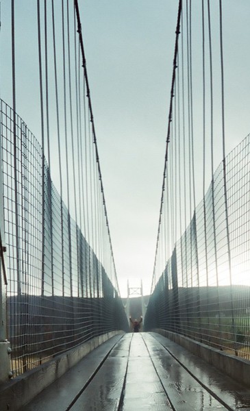
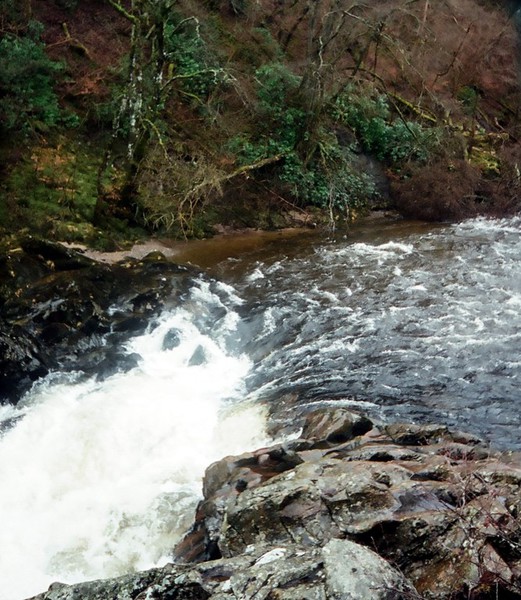
The succeeding rout saw the Government forces flee down the steep slope to the river, where one soldier, Donald McBane leapt 18 feet across the River Garry to safety, a place now known as the
"Soldier's Leap." As you can see in the picture below, Lance thought about it.
 Lance at the Soldier's Leap, Killicrankie.
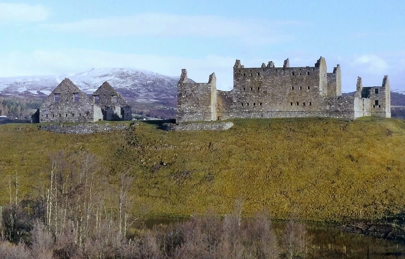 Ruthven Barracks near Kingussie